

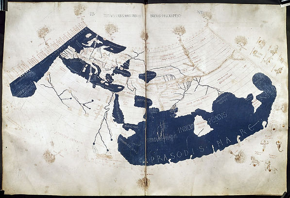
Ptolemy's World Map (2nd/15th Century CE)
Claudius Ptolemy (c. 90-168 CE) was a mathematician, astrologer, astronomer, and geographer of Greek descent who lived in Alexandria. Around 150 CE, he synthesized the extensive geographic knowledge of the Greek and Roman empires in Geography. Geography evaluated previous measurements of the earth, suggested methods for projecting a spherical earth onto a plane, provided a topographical account of the latitude and longitude of more than 8,000 locations throughout Europe, Asia, and Africa, explained the role of astronomy in geography, and provided a mathematical guide for making maps of the Earth and its regions. After its creation, Geography disappeared for thousands of years, only to reappear as copies in 13th century Byzantium along with maps created by Byzantium scribes using the information provided by Ptolemy. The information in Geography would have a profound impact on mapmaking, and in the latter part of the 15th century, Ptolemaic maps spread across Europe, thanks in part to the newly invented printing press. However, Geography contained significant inaccuracies, attributable in part to Ptolemy's miscalculation of the size of the Earth, which he believed was smaller than it is. This, too, would have a profound impact, famously leading Columbus to believe that he could sail around the world in a shorter time than was actually the case. This is a map created in the 15th century from the information Ptolemy provided. For a tour of Ptolemy's map, click here.