

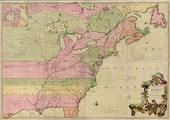
John Mitchell, Thomas Kitchin, & Andrew Millar, A Map of the British and French Dominions in North America (1755)
At the request of the English Board of Trade and Plantations, the equivalent of the U.S. State Department, John Mitchell prepared this large map of North America based upon maps provided by each of the thirteen colonial governors. The map implies British control of North America from the Atlantic Ocean westward past the Mississippi and, eventually, to the Pacific Ocean--from "sea to sea"--as evidenced by the horizontal colonial boundaries extending into French territory. Indeed, when the King of Great Britain issued charters establishing colonies like Virginia and North Carolina, their eastern boundary was the Atlantic Ocean and their western boundary was the Pacific Ocean, ignoring land ownership by Native Americans, France, Spain, or any other nation. Western boundaries for these states were established only after they ceded their western lands to the government following the adoption of the Articles of Confederation in 1781. Published at the outset of the French and Indian War, this was one of several maps prepared for a British audience in an attempt to reinforce opinions regarding British control of North America. It was also used to establish boundaries of the United States at the 1783 Treaty of Paris that ended the Revolutionary War.