

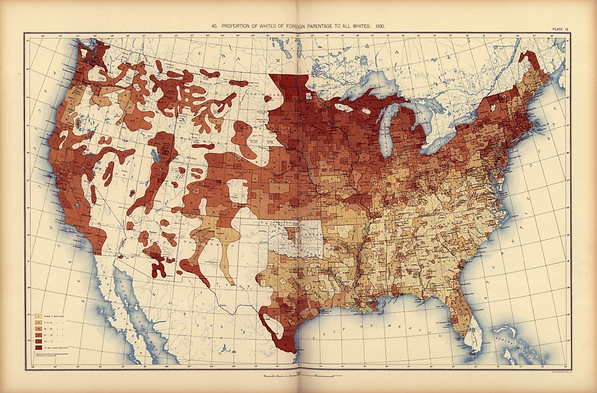
U.S. Census Office, Proportion of Whites of Foreign Parentage to All Whites (1898)
This choropleth map, published in the Statistical Atlas of the United States Based upon the Results of the Eleventh Census under the direction of Henry Gannett, depicts the proportion of individuals born to White immigrant parents relative to the total population across the United States. Darker shading indicates a higher percentage of individuals born to White immigrants in a given area. The map reflects immigrant settlement patterns by highlighting where immigrant families established themselves and raised children. The highest concentrations appear along the East Coast, the Midwest, and the West Coast. The prominence of the East Coast reflects its role as the primary point of entry for immigrants, as most ports of entry were located there. High concentrations on the West Coast, particularly in California, are associated with immigration during events such as the Gold Rush, including significant Chinese migration. The Midwest also attracted large numbers of immigrants due to its relatively low population density, availability of land, and expanding economic opportunities.